

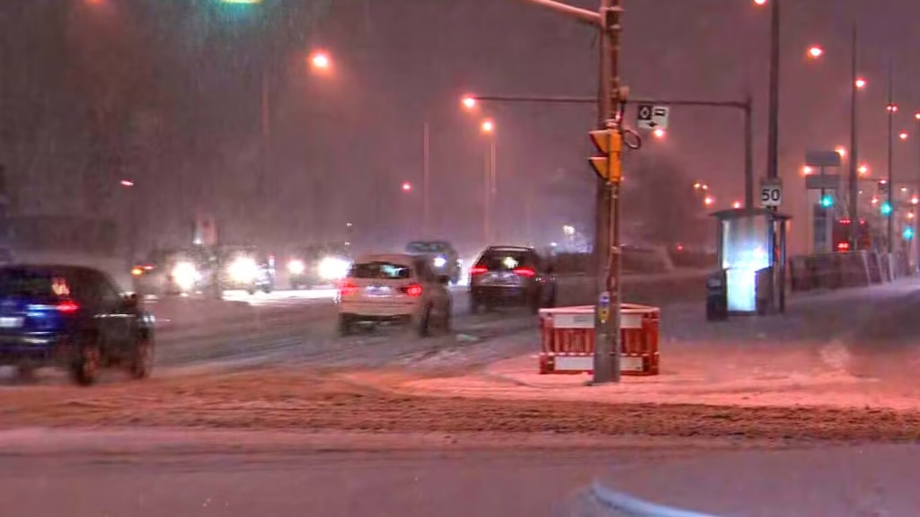
Toronto — A snowfall warning for the city has been lifted, but a powerful winter storm left widespread disruption across the Greater Toronto Area (GTA) on Wednesday, contributing to roughly 200 collisions, slowing transit, and prompting school bus cancellations and airport delays.
Environment Canada ended Toronto’s snowfall warning late Wednesday afternoon, though several neighbouring communities — including Newmarket, Northern York Region, Pickering, Oshawa and parts of Durham Region — remain under weather advisories. Snow gradually turned to rain across much of the GTA by evening, but temperatures are expected to drop below freezing overnight, raising concerns about icy roads.
About 200 crashes reported across GTA
Ontario Provincial Police (OPP) say officers responded to approximately 200 collisions from early morning through late afternoon as heavy, wet snow blanketed highways and arterial roads.
OPP Sgt. Kerry Schmidt warned that improving visibility does not eliminate the risk.
“With the numbers already at 200 and temperatures dropping, those icy sections could be very slippery,” Schmidt told CP24. “Drivers need to stay vigilant and adjust to the conditions.”
The OPP said earlier in the day that collision volumes led to extended wait times for roadside assistance.
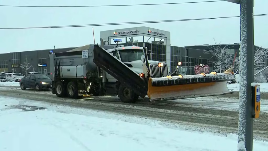
City ramps up plowing and salting ahead of freezing temperatures
The City of Toronto began full salting and plowing operations Wednesday afternoon, saying crews would clear all roads — including those that would not normally meet plowing thresholds — to prevent slush from freezing overnight.
Sidewalk salting is expected to continue into Thursday and possibly Friday, depending on conditions.
In Mississauga, the city temporarily suspended all on-street parking to allow plows to operate effectively.
Transit disruptions as TTC adjusts to conditions
The TTC reported multiple delays and detours on surface routes throughout the day. The 902 Markham Road Express was forced to detour northbound, while weather-related slowdowns affected the 96 Wilson, 70 O’Connor and 996 Wilson Express routes.
TTC spokesperson Stuart Green said several buses were briefly stuck on steeper roads but were quickly freed. Additional crews were deployed to clear platforms, stairs, and switches.
“This is a very odd storm,” Green noted, with snowfall amounts varying significantly across the city. Downtown Toronto saw just a few centimetres, while higher elevations north of the city accumulated upward of 10 centimetres.
Airport operations slowed, school buses cancelled
Toronto Pearson International Airport reported about six centimetres of snow by mid-morning and experienced some flight delays as crews cleared runways and taxiways.
School buses were cancelled in York Region and Durham Region earlier in the day due to dangerous road conditions.
Snowfall varies widely; northern areas face snow squalls
Weather specialists say the storm’s impact depended heavily on location. Downtown accumulation was around five centimetres, but communities north of Highway 401 saw significantly heavier snowfall.
Environment Canada issued snow squall warnings for areas north of Toronto, including Barrie, Collingwood, Innisfil, and New Tecumseth. Local snowfall totals in those regions could reach 30 to 50 centimetres, with near-zero visibility at times.
“Whatever is on the ground will likely freeze later today,” CTV News Toronto weather specialist Jessica Smith said. “That wet snow will become very hard and icy.”
Road conditions remain a concern into Thursday
Highway ramps were among the slickest areas, with snow and slush accumulating despite ongoing clearing operations. OPP cautioned drivers that even as the storm passes, freezing temperatures will create persistent icy patches on highways and local roads.
The system is expected to taper off through the evening, though crews say cleanup efforts will continue overnight and into Thursday.
